ANZ533 Forecast Issued: 459 AM EDT Sat May 30 2026
SMALL CRAFT ADVISORY IN EFFECT THROUGH THIS EVENING
Rest Of The Overnight...Nw Winds 10 Kt. Waves 2 Ft.
Today...N Winds 15 To 20 Kt With Gusts To 25 Kt. Waves 3 Ft.
Tonight...Ne Winds 10 To 15 Kt With Gusts To 20 Kt... Becoming E 5 To 10 Kt After Midnight. Waves 2 To 3 Ft.
Sun...N Winds Around 5 Kt. Waves 1 Ft.
Sun Night...S Winds 5 To 10 Kt. Waves 1 To 2 Ft.
Mon...W Winds 5 To 10 Kt...Becoming N In The Afternoon. Waves 1 Ft.
Mon Night...Ne Winds 5 To 10 Kt. Waves 1 Ft.
Tue...Ne Winds 5 To 10 Kt. Waves 1 Ft.
Wed...N Winds 5 To 10 Kt. Waves 1 Ft.
SHARE THIS PAGE:
Area Forecast Discussion National Weather Service Baltimore MD/Washington DC 337am EDT Sat May 30 2026
.WHAT HAS CHANGED... No notable changes were made to the forecast with this update.
.KEY MESSAGES... - 1) Dry and seasonable to end the week. Slightly cooler and continued dry during the weekend.
- 2) Near to below normal temperatures for the early to middle portions of next week with low rain chances.
KEY MESSAGE 1...Dry and seasonable to end the week. Slightly cooler and continued dry during the weekend.
An upper level low will move by to the north today into Sunday, bringing a dry cold front southward through the region. This front will likely only bring some additional clouds and a decent push of northerly winds today, but no rainfall. Highs today will only reach the low to mid 70s (60s mountains) and overnight lows in the 40s and 50s. Would not be surprised if colder sheltered high elevation valleys have some patchy frost tonight. Sunday will be similar in terms of temperatures during the day, but about 5 degrees warmer Sunday night.
Warmer temperatures are forecast for Monday, but only by about 5 degrees areawide. Another dry frontal boundary will push through during the day on Monday, this one a bit weaker than the previous front. Again, only notable change will be a wind shift, with no precipitation in the forecast at this time.
KEY MESSAGE 2...Near to below normal temperatures for the early to middle portions of next week with low rain chances.
The upper level low bringing clouds early on in the week will start to transition offshore on Tuesday and going into Wednesday. Some moisture could linger in the region during this time, with a few pop- up showers possible, but dry air aloft will likely prevent anything widespread at this time. The timing of this system still differs a bit in model guidance, but general agreement shows surface high pressure moving into the region by Wednesday and going into Thursday. Additional dry air moves into the area at this time, minimizing rain chances. As this surface high tracks east, temperatures could start to creep up a bit. Behind it, a cold front could approach from the northwest at the start of next weekend. Overall, expect persistent moderate temperatures and low rain chances through the end of the week, with temperatures trending upward by Friday.
Marine A cold front will push through this morning, with an SCA (Small Craft Advisory) in effect through late this evening in northerly flow.
Northwest winds Sunday morning become southerly Sunday afternoon, and should remain well below SCA (Small Craft Advisory) criteria.
Another front will push through on Monday, turning winds out of the north once again. However, they should be weaker than the current front, so SCAs (Small Craft Advisories) not expected at this time.
Winds flow primarily northerly Tuesday and Wednesday. Marginal SCA (Small Craft Advisory) conditions are possible towards the southern portions of the Bay on Tuesday and Wednesday afternoon as low pressure meanders offshore during then. Otherwise, gusts range 5-10 knots.
Tides / Coastal Flooding Tidal anomalies remain elevated this morning ahead of an approaching cold front. No flooding is forecast, but Annapolis could be close with the ongoing high tide.
A return of southerly flow will bring another surge Sunday night. Guidance indicates a greater chance of minor flooding during this period, especially in the northern portion of the Chesapeake Bay.
Marine Small Craft Advisory until 8pm EDT this evening for ANZ530- 531-538-539. Small Craft Advisory until 11pm EDT this evening for ANZ532- 533-540-541. Small Craft Advisory until 11pm EDT this evening for ANZ534- 537-543. Small Craft Advisory until 8pm EDT this evening for ANZ535- 536-542.

 Baltimore/Washington Radar
 Northeast Radar
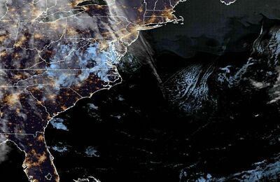 East Coast Satellite